


07-1 Blackman Elementary School Voting District, Rutherford County, Tennessee
About
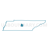
Outline

Summary
| Unique Area Identifier | 669462 |
| Name | 07-1 Blackman Elementary School Voting District |
| County | Rutherford County |
| State | Tennessee |
| Area (square miles) | 16.17 |
| Land Area (square miles) | 16.17 |
| Water Area (square miles) | 0.00 |
| % of Land Area | 100.00 |
| % of Water Area | 0.00 |
| Latitude of the Internal Point | 35.77320780 |
| Longtitude of the Internal Point | -86.48507440 |
Maps


Graphs
Select a template below for downloading or customizing gragh for 07-1 Blackman Elementary School Voting District, Rutherford County, Tennessee


Neighbors
Neighoring Voting District (by Name) Neighboring Voting District on the Map
- 07-2 Riverdale High School Voting District, Rutherford County, TN
- 07-3 Middle TN Electric Membership Corp Voting District, Rutherford County, TN
- 08-3 Lebanon Camp Church Voting District, Rutherford County, TN
- 08-4 Rockvale Community Center Voting District, Rutherford County, TN
- 13-2 World Outreach Church Voting District, Rutherford County, TN
- 20-2 Blackman Middle School Voting District, Rutherford County, TN
Top 10 Neighboring County Subdivision (by Population) Neighboring County Subdivision on the Map
- District 7, Rutherford County, TN (16,401)
- District 20, Rutherford County, TN (16,296)
- District 8, Rutherford County, TN (14,479)
- District 13, Rutherford County, TN (13,622)
Top 10 Neighboring Place (by Population) Neighboring Place on the Map
Top 10 Neighboring Elementary School District (by Population) Neighboring Elementary School District on the Map
Top 10 Neighboring Secondary School District (by Population) Neighboring Secondary School District on the Map
Top 10 Neighboring Unified School District (by Population) Neighboring Unified School District on the Map
Top 10 Neighboring State Legislative District Lower Chamber (by Population) Neighboring State Legislative District Lower Chamber on the Map
- State House District 34, TN (101,480)
- State House District 48, TN (75,364)
- State House District 62, TN (68,966)
Top 10 Neighboring State Legislative District Upper Chamber (by Population) Neighboring State Legislative District Upper Chamber on the Map
Top 10 Neighboring 111th Congressional District (by Population) Neighboring 111th Congressional District on the Map
Top 10 Neighboring Census Tract (by Population) Neighboring Census Tract on the Map
- Census Tract 409.03, Rutherford County, TN (10,129)
- Census Tract 407.01, Rutherford County, TN (8,751)
- Census Tract 409.02, Rutherford County, TN (8,542)
- Census Tract 409.05, Rutherford County, TN (7,909)
- Census Tract 408.08, Rutherford County, TN (6,313)
- Census Tract 409.04, Rutherford County, TN (4,623)
- Census Tract 408.09, Rutherford County, TN (3,749)